![[D]](../../templates/images/logos/flag-de.png)
![[E]](../../templates/images/logos/flag-en.png)
Navigation: Home › The model › Special features › Lake module
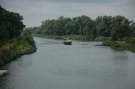
Lake module
Starting with WaSiM 8.0.10 lakes can be definiert explizitly in WaSiM. Lakes are now coupled to the unsaturated zone and the groundwater model.
New features:
- Consideration of lake evaporation using internally a separate approach (Penman-Monteith with zero resistances etc.)
- Calculation of lake water balance with all important fluxes and entities (see below)
- Output of extended statistic files (per-time-step balance) in one file per lake/reservoir
Output per lake with following entites:
- Water table elevation
- Lake area
- Lake water volume
- Inflows from above (tributaries and inbetween area)
- Lake outflow following outflow rules
- Evaporation losses
- Irrigation losses
- Exchange with groundwater
- Precipitation input
- Volume change per timestep (this is the balance)
- Abstractions (e.g. for power generation or drinking water)
- error estimation (because of numeric rounding errors when adding small numbers to large numbers)
- Tracer concentrations
Prerequisites for using the lake module:
- Preparation of a lake grid with unique codes for each lake (all lake cells for a lake get the same code) -> This is teh lake area at maximum water level!
- Preparation of a MAXPOND grids with maximum water depth for each lake cell (former name: POND-Grid)
- Creation of a new section in the control file for the lake model
- Defining lakes in the routing descriptions
Details on the ![]() lake module (this document is part of the WaSiM model documentation)
lake module (this document is part of the WaSiM model documentation)